Mammoth Lakes
Home to lakes and beautiful views in eastern Sierra.
Destination: Mammoth Lakes, California
Dates: Oct 4-7, 2019
Places Visited:
- Convict Lake
- Mammoth Village
- Sherwin Creek Road
- Hot Creek Geological Site
- Earthquake Fault
- Mammoth Scenic Drive
- Twin Lakes
- Lake Mary
- Horseshoe Lake
- Mono Lake Park & Vista Point
- Lake Ellery
- Tioga Pass
- June Lake loop
- June Lake Beach
- Lake Sabrina
- Mt. Whitney Fish Hatchery
Food Stops:
Stay: Sherwin Villas, through AirBnb (hosted by Anja)
Story:
I and my wife wanted a break from our daily busy routine life. We were looking for some peaceful and relaxing getaway. That's the reason we chose mammoth lakes in off-season. The whole purpose of this trip was to relax, be out from city hustle and keep ourselves away from office work.
- Day 1:
- Day 2:
- Day 3:
- Day 4:
Its was sunny beautiful day and our long awaited trip was about to start. We had our breakfast, packed lunch and got ready for a long 4 days vacation. We started from our home in Woodland Hills at 12 noon. The traffic was light as it was a friday (non-holiday), google map was showing 4.5 hours drive to mammoth lakes. We took the US-101 South, then to I405 north, merge into I-5 north and finally to CA-14 North which again merges into US-395 leading to mammoth lakes.
While driving we passed the beautiful Red rock canyon State Park, though we didn't go inside the park, but the red rocky mountain can be seen on the way in CA-14. After approx 3.5 hours of driving we took crossed Bishop (largest populated city in Inyo county) and headed into the Inyo National Forest area. After about 45 mins drive, we reached our first stop in Mammoth Lakes basin. This was Convict Lake.
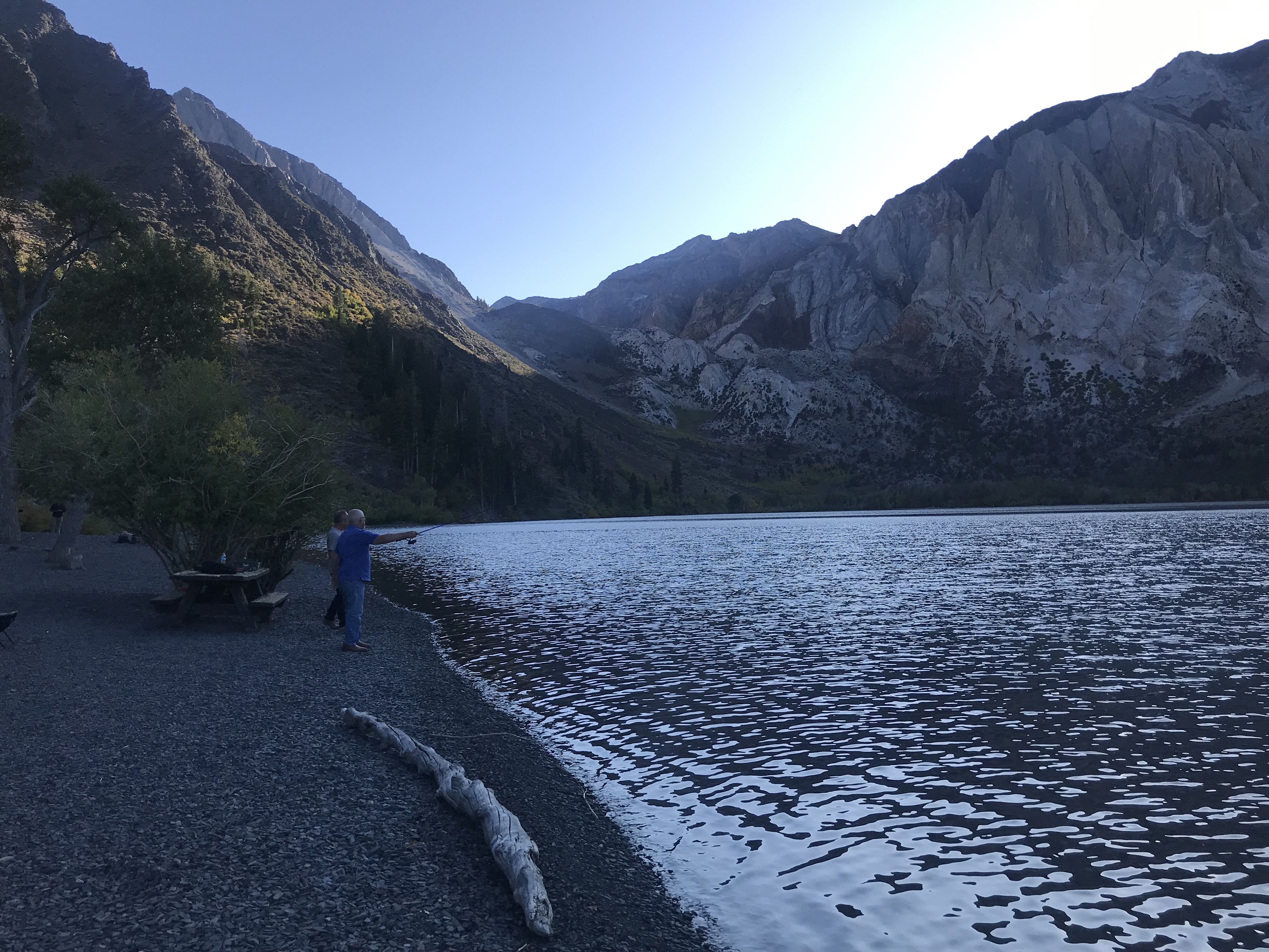
Convict Lake
It is situated in the Sherwin Range of the Sierra Nevada mountains. It is known for its turquoise-blue water, the dramatic mountains (including Mount Morrison) that surround it, for the trout fishing it affords. It was so peaceful and relaxing to sit and watch the waters and sunset behind the mountains. We sat there for a bit and had our lunch. After an hour, once the tempreature began to fall, we headed to our airbnb stay.
We booked an airBnb stay in mammoth lakes town, on the old mammoth lakes road in Sherwin villas. The condo was perfect for a family with kid. We relaxed there for an hour and then went out to visit the Village at Mammoth.
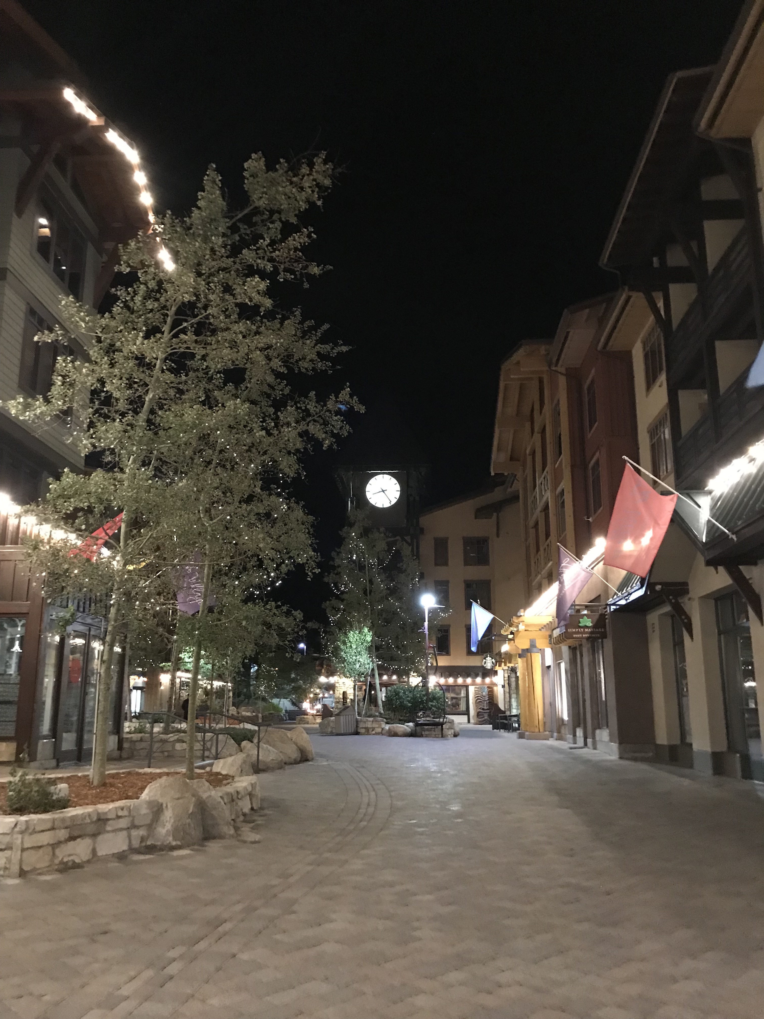
The Village at Mammoth
This is a place where most visitors drop by in evenings. It is a small shopping area with some hotels and lots of restaurants. During season, you can find live music bands playing here, also there is a gondola that takes you to the top of mammoth mountains. There are lifts as well for ski lovers. But as we were there in off-season, the lifts were not operating (as there was no snow), also the gondolas were closed for maintenance and where planned to re-open in november. During off-season, you can enjoy the restaurants and cafes, and shop for souvenirs.
Since the temperature starts dropping rapidly in evenings, we decided to head back to home and relax. The start of our vacation was nice with visits to convict lake and village, we were looking for more scenic places to visit during our trip in next 3 days.
Second day started with a bad news, there was a power outage in almost whole of mono county (mammoth lakes is part of mono county) to avoid forest fire due to some damaged lines and high winds in the area. We just got freshen up and started for further exploration of the area.
Our little 9 months old baby is not very good in sleeping unlike me and my wife :), so we decided to keep driving for atleast an hour before stopping so that she can sleep in the car seat (she sleeps when car is in motion). So we first took a drive to Sherwin creek road.
Sherwin Creek Road
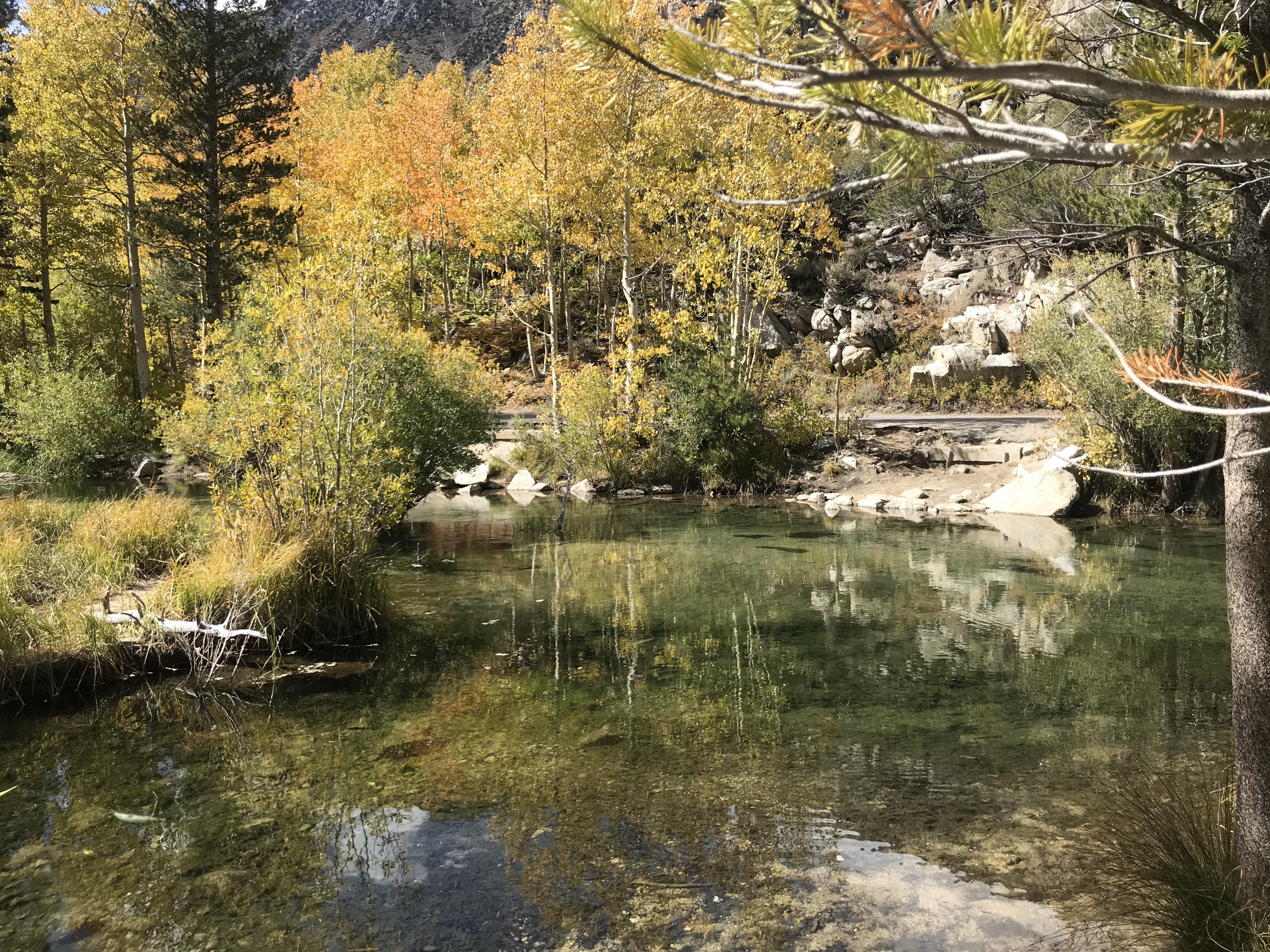
While driving south side on Old mammoth road, take a left on to Sherwin creek road, just after mammoth creek road. I took this road in search of some fall colors, but ended up reaching an off-road path. For first couple of miles, there was proper pitch road, post that it was dirt road. This was the first time I took my Toyota Rav4 on an off-road drive. After driving approx 4-5 miles on dirt road, it took us to US-395 just before the Mammoth-yosemite airport. From here we took US-395 and planned to visit Hot Creek Geological Site.
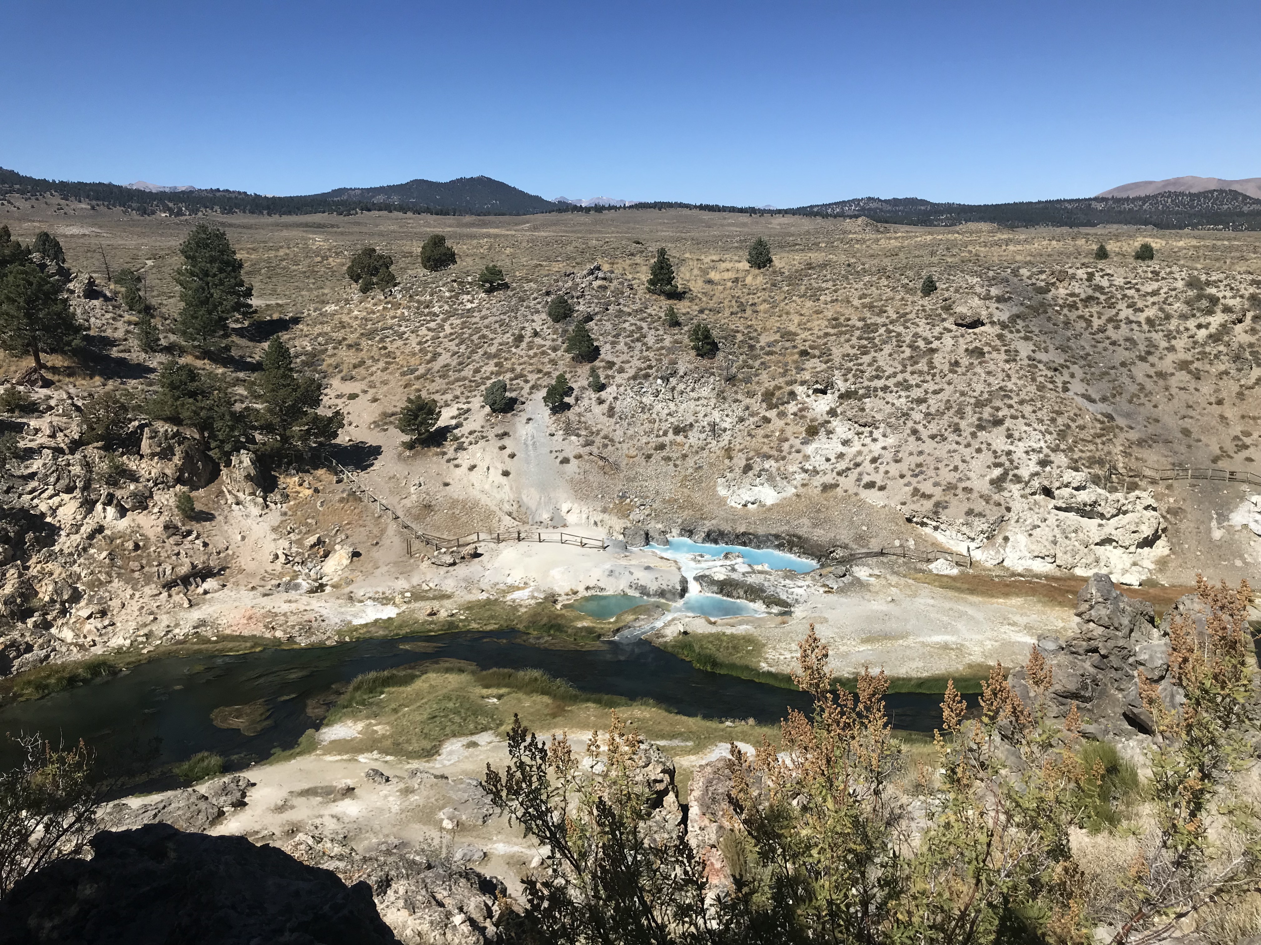
Hot Creek Geological Site
To reach Hot creek, take a left from US-395 S, just before Mammoth-yosemite airport. This is a 3.5 mile drive from the highway, which includes 2 miles of pitch road and 1.5 miles of dirt road (another off-road drive). There is a small parking lot near the vista point. From here you need to hike down to reach near the hot creek. Though the gysers are visible from top as well from the vista point. With an infant we decided not to hike down as it seemed to be steep trail, difficult to trek back. After taking some nice photos and enjoying the view, we headed next to Earthquake fault. While driving back towards US-395, the road was so deserted, we enjoyed some nice music and dance on road.
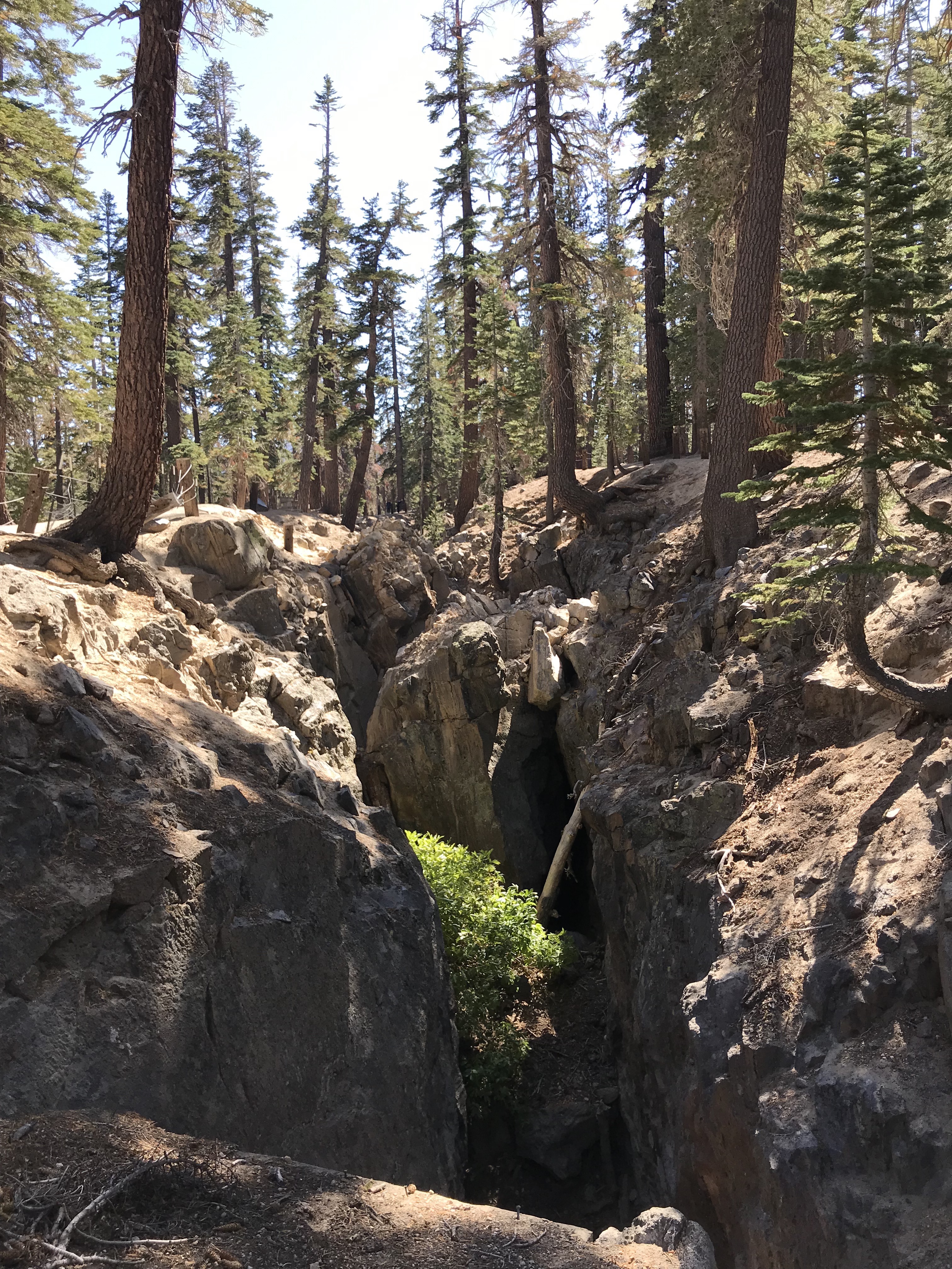
Earthquake Fault
From US-395 take the Mammoth Lakes (CA-203) exit, then make a left. From CA-203 (Main St) make a right onto Minaret Rd. The Earthquake Fault is located just up the hill on the right hand side. This is a place of gelogical interest. The Earthquake Fault cuts through volcanic rock, part of a glassy rhyolite lava flow from Mammoth Mountain, and formed by tectonic stresses in the earth's crust. The fault lines up with the Inyo-Mono Craters and is believed to be part of the east-west stretching that is gradually widening the entire Basin and Range region. A short walking trail surrounds this natural phenomenon. It was a nice picnic spot with majestic red fir and Jeffrey pine trees in the surrounding. We chose this place to feed our baby some fruits and then headed to drive through Mammoth Scenic Drive
Mammoth Scenic Drive
Driving down from Earthquake fault towards Main St (CA-203), take a left towards Mammoth Scenic Drive. This is a 6 mile loop strechting from Minaret Road (CA-203) and ending in US-395. The loop is full of pine trees on both sides and have a number of campsites and RV parks. This loop will look much nicer after snow. After finishing this loop we went back to our condo to grab some lunch and feed our baby.
After taking some rest and lunch, we planned to visit the Lake Mary area. Our first stop on this way was Twin Lakes.
Twin Lakes
Twin Lakes is a set of connected lakes at the base of the Mammoth Mountain. Twin Lakes are the lowest lakes in the Mammoth Lakes Basin. On one side of the lake are lava cliffs that were formed by eruptions of Mammoth Mountain. The other side of the lake has the Inyo National Forest's Twin Lakes Campground, and Tamarack Lodge of the Mammoth Mountain Ski Area. There twin falls flowing down into this lake, which can be seen on the other side of the lake. There is forest chappel just behind the lake which is again one of the scenic chapel I have seen.
Lake Mary
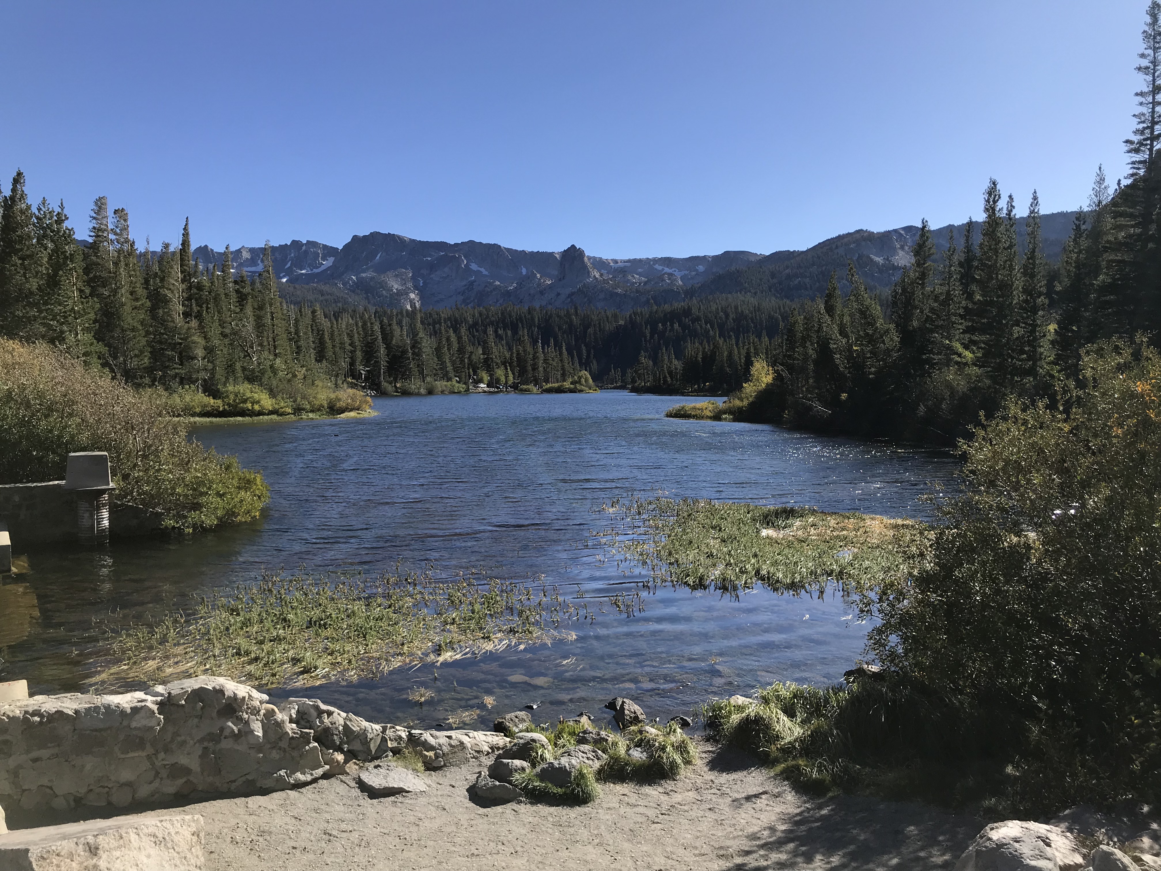
After watching the scenic twin lakes and its surrounding we headed towards Lake Mary. Lake Mary is a freshwater lake and largest in Mammoth Lakes basin. It has lot of activities. We saw people kayaking, boating, fishing, camping. We decided not to stop here, as for some reason, the beach area of the lake was closed. So we decided to head higher up towards Horseshoe Lake.Horseshoe Lake
This was the last accessible lake on the Lake Mary road. There are other lakes on higher altitude like McCloud Lake, but you need to hike from horseshoe lake to reach there. Horseshoe lake had a nice beach and surrounding. We setup our pop-up tent here to feed our baby. We spent around 45 mins to an hour relaxing and grabing some snacks and tea. One thing to notice here are dead trees, after reading some details about this place, I found that the soil near the lake has high concentration of CO2 (carbon dioxide), which seeps from the soil and kills the trees.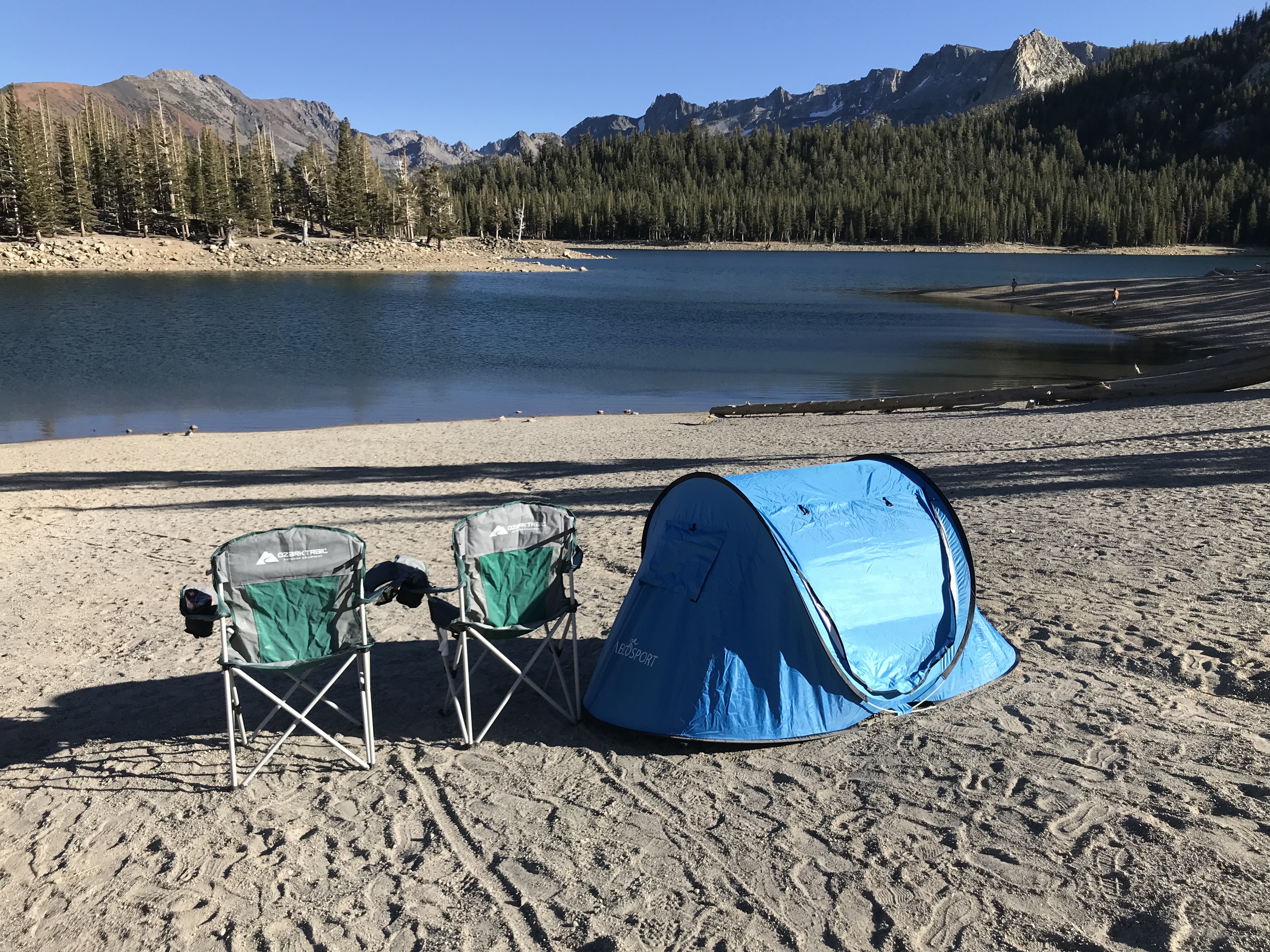
After visiting horseshoe lake, we planned to head back to our condo. On the way, we made a pit stop at Twin Falls overlook, which gives a panormic view of twin lakes. We also made another stop at twin lakes and then a final stop at Village at mammoth to see this place before dark. After spending 30 mins at village we retuned back to our condo. Since it was my birthday, we decided to go out for dinner, but most of the restaurants in mammoth are closed in off-season. We luckily we found a nice pizza place, Giovanni's Pizzeria near Vons in Minaret Village Shopping Center.
This day we planned to go to Bodie, a ghost town somewhere in the sierra mountains, but we got little late in starting from home and since we didn't wanted to rush to make sure we are having a relaxed trip we dropped our plan for Bodie. After having breakfast and packing our lunch, we headed to mono lake.
Mono Lake
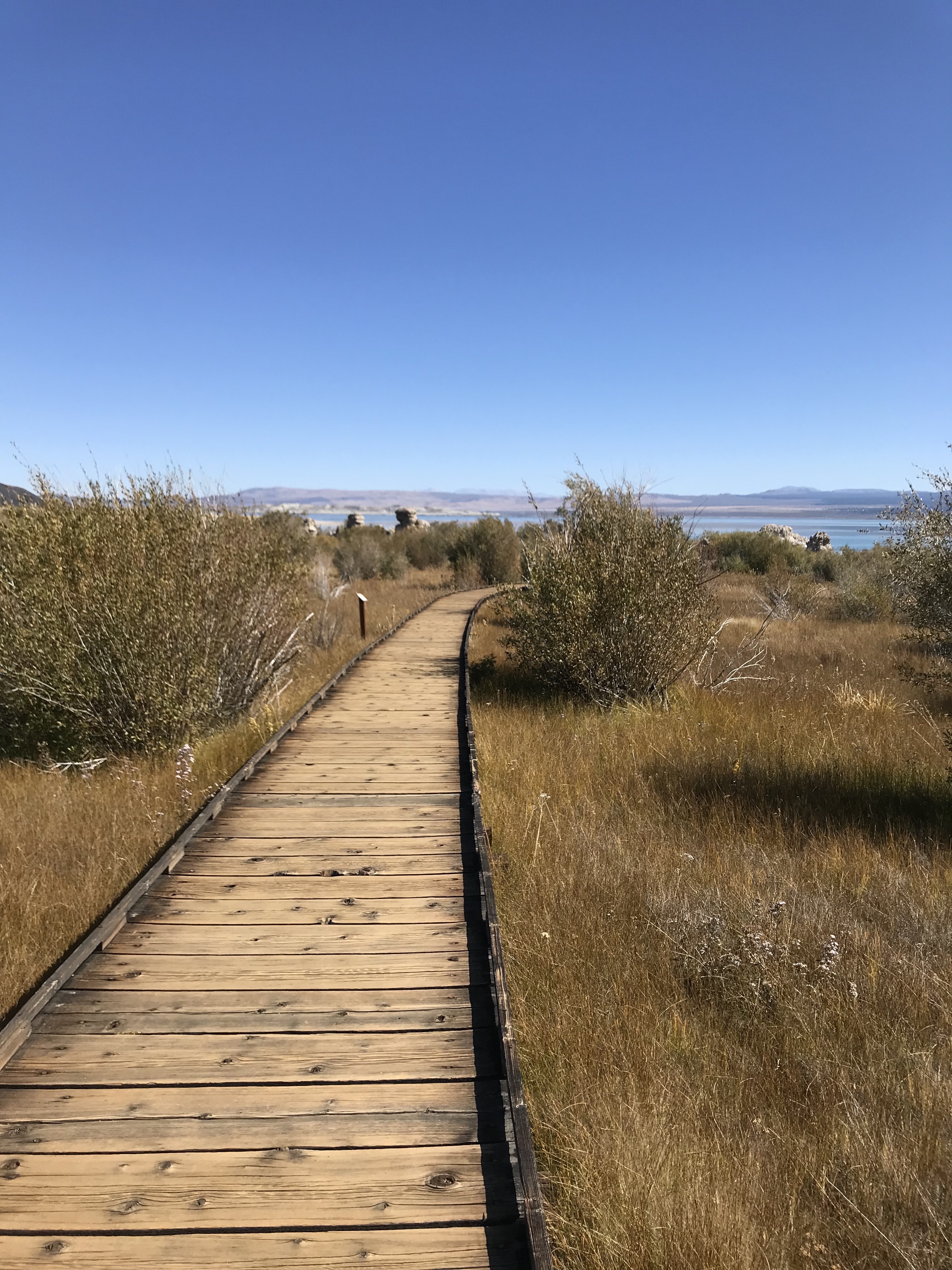
Mono Lake is a saline soda lake in Mono County, California, formed at least 760,000 years ago as a terminal lake in an endorheic basin. The lack of an outlet causes high levels of salts to accumulate in the lake. These salts also make the lake water alkaline. Head from Mammoth lakes to US-395 north, after crossing a small town of Lee Vining, you will be able to Mono Lake. There are lots of view points on the way. We headed to Mono Lake Park, a small park with a boradwalk which takes you near to the lake but lake isn't accessible from this park. There are other vista points and places to access the lake. This lake has tufa formations, which is caused due to the salanity of the lake water. You can make a short walk to Mono Lake boardwalk to see the strange tufa rocks emerging from the clear lake. we stayed for 20 mins went near to the lake and then headed to Tioga Pass and Ellery Lake.
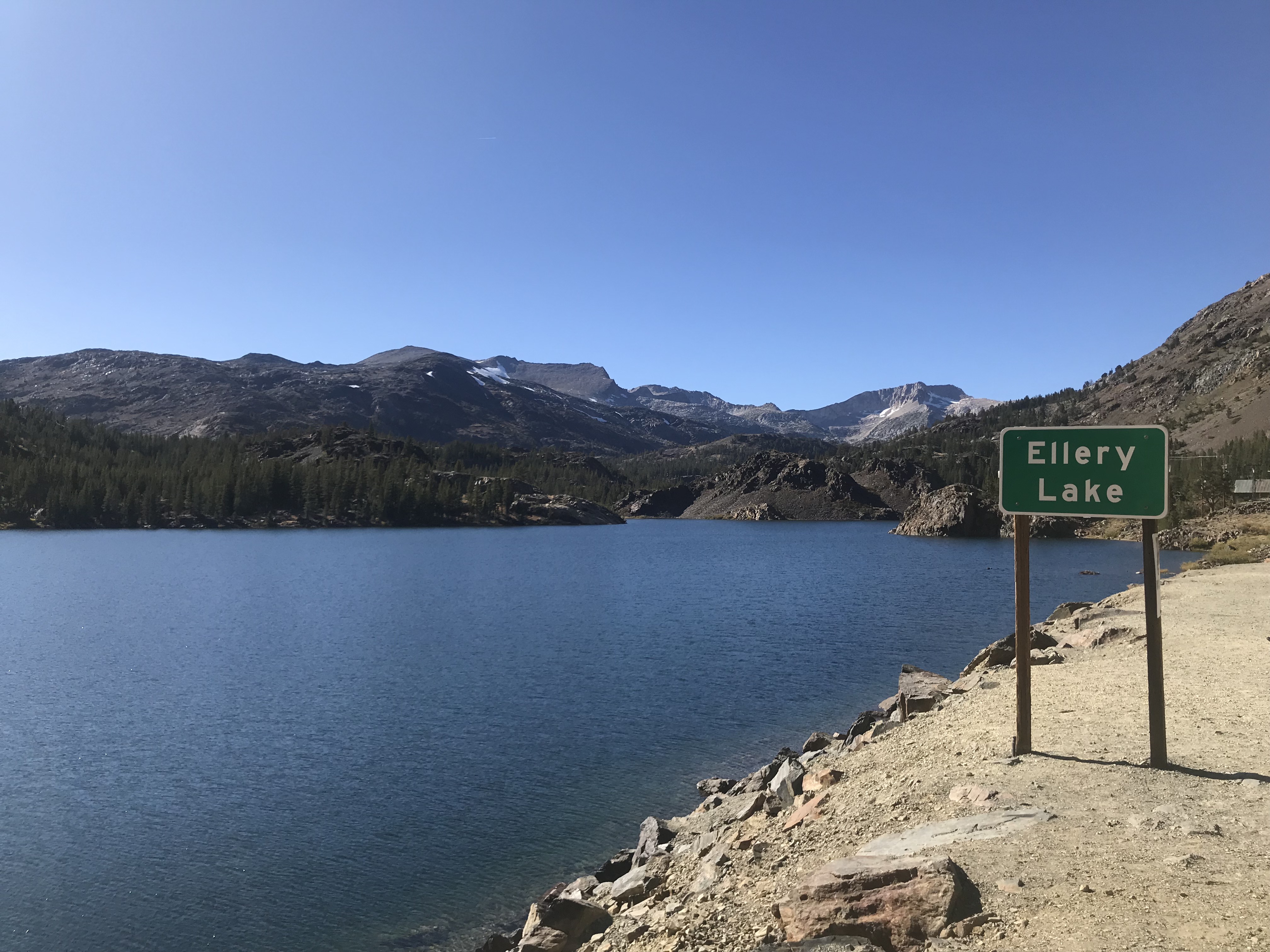
Ellery Lake and Tioga Pass
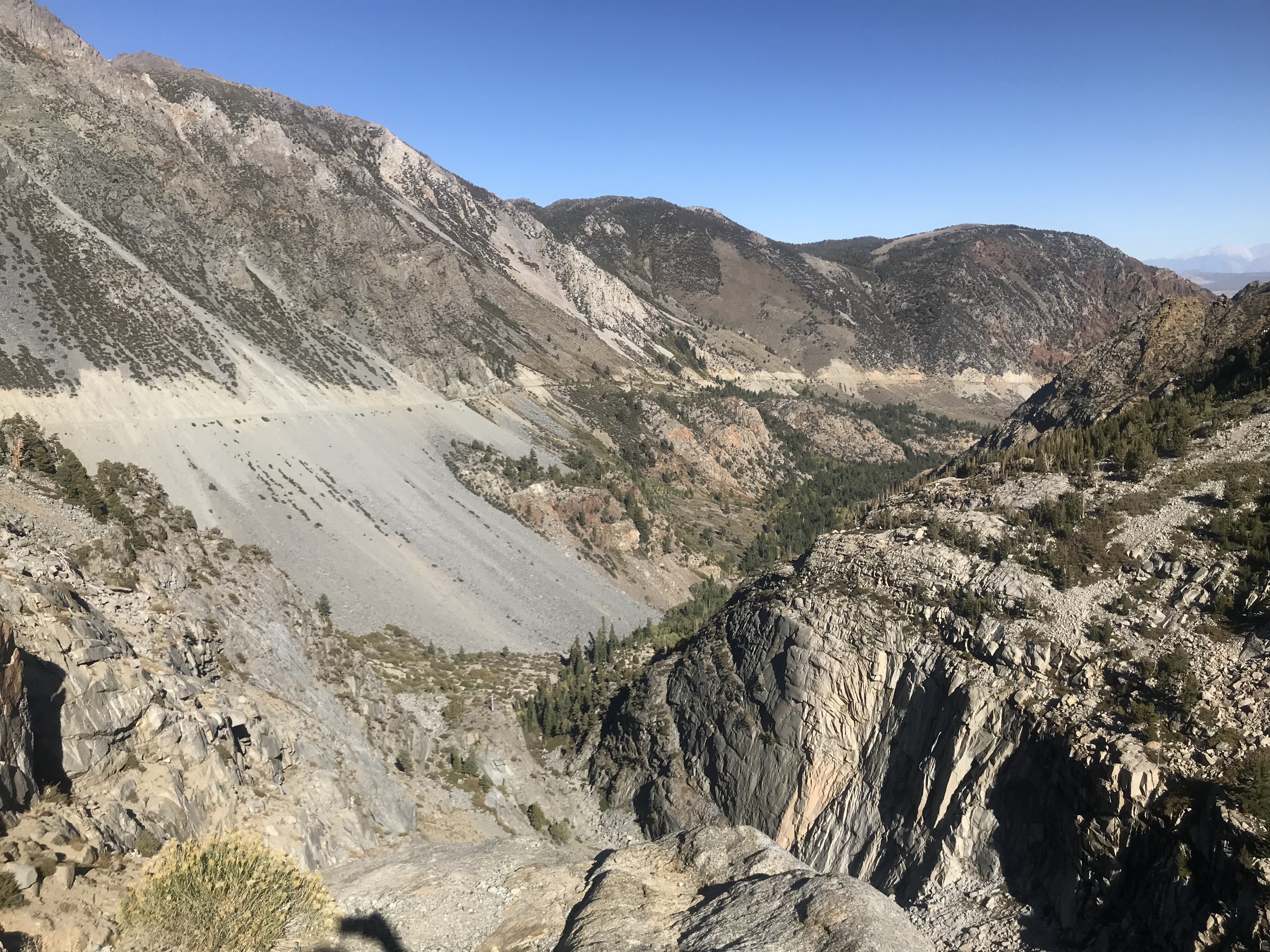
Tioga Pass is a mountain pass in the Sierra Mountains of California. CA-120 runs through it, and serves as the eastern entry point for Yosemite National Park, at the Tioga Pass Entrance Station. It is the highest highway motorable road in California. There are several trailheads into the Yosemite backcountry which begin at Tioga Pass. It is also home to many lakes like Lake Ellery, Tioga Lake, Saddleback lake etc. We made a pit stop at Lake Ellery and couple of other vista points. The views of the lake and valley was breath-taking. There is waterfall flowing from Lake Ellery into the valley. It is considered as one of the marvel of civil engineering.
After driving through the Tioga Pass, we returned back to Lee vining town and had a stop at Mono Cone, a small ice cream parlor. This place has nice selection of ice-creams and snacks, the only drawback is they are cash-only shop. There is a small museum just 100 ft behind the shop, with an upside down house which was brought to this place in 2000. After enjoying our ice-cream we headed towards June Lake Loop.
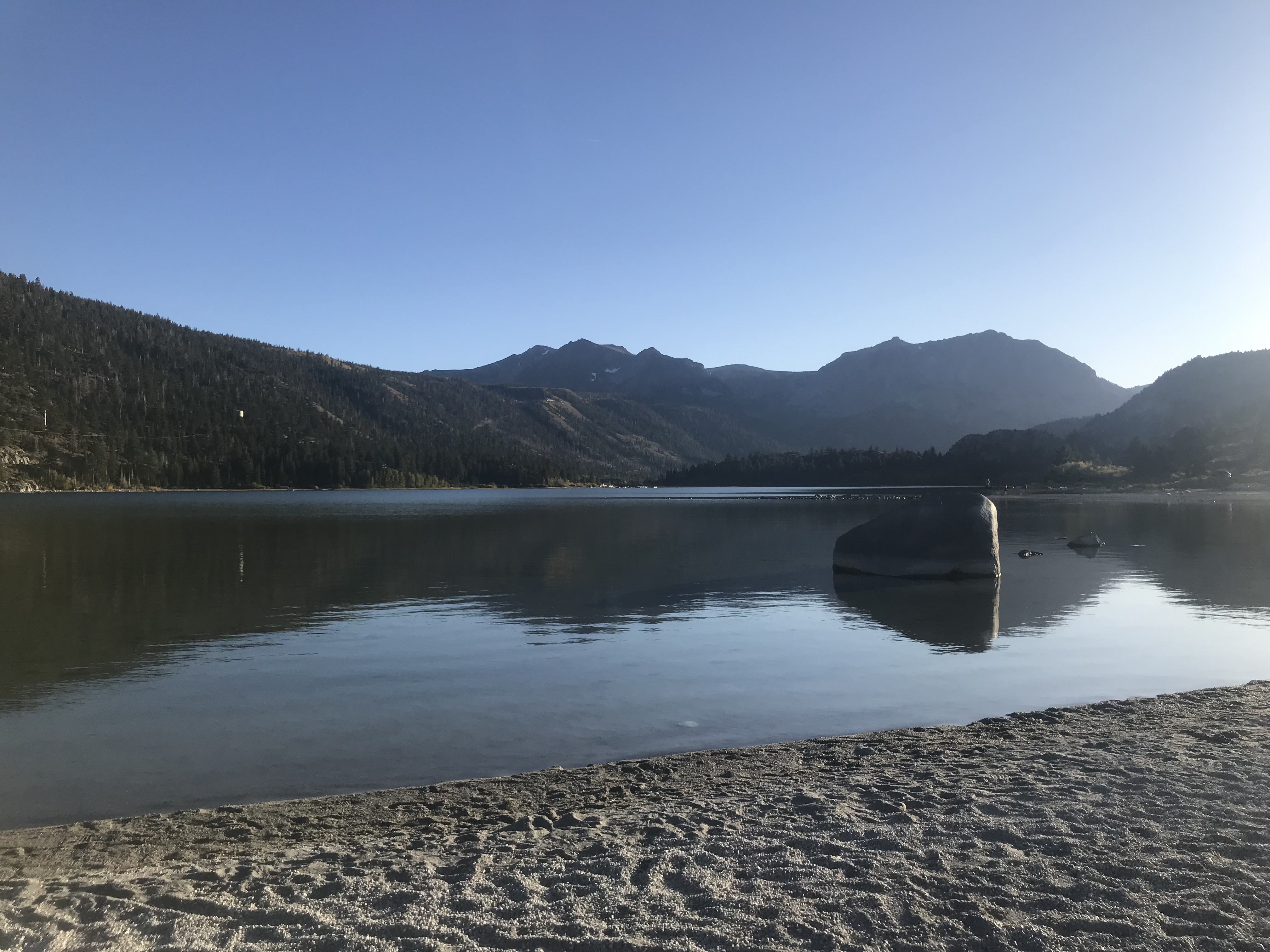
June Lake Loop and June Lake beach
June Lake loop is a 16 mile loop. Take a right from US-395 while coming from Lee Vining. This loop passes through 4 lakes Grant Lake, Silver Lake, Gull Lake and June Lake. There are lots of camp grounds and lodge on this loop and there is a small village named as June Lake Village near to June Lake. We made a stop at June Lake beach to feed ourselves and our baby. This was another spot where we pulled out our pop-up tent. We stayed there for an hour watching the sunset and enjoying the views. You can witness birds, ducks and deer near the beach. This was the last stop for us on Day 3. We headed back to our condo and relaxed in the evening.
After checking-out from the condo at 12 noon on fourth and final day of our vacation, we planned to visit Lake Sabrina in search of some nice fall colors.
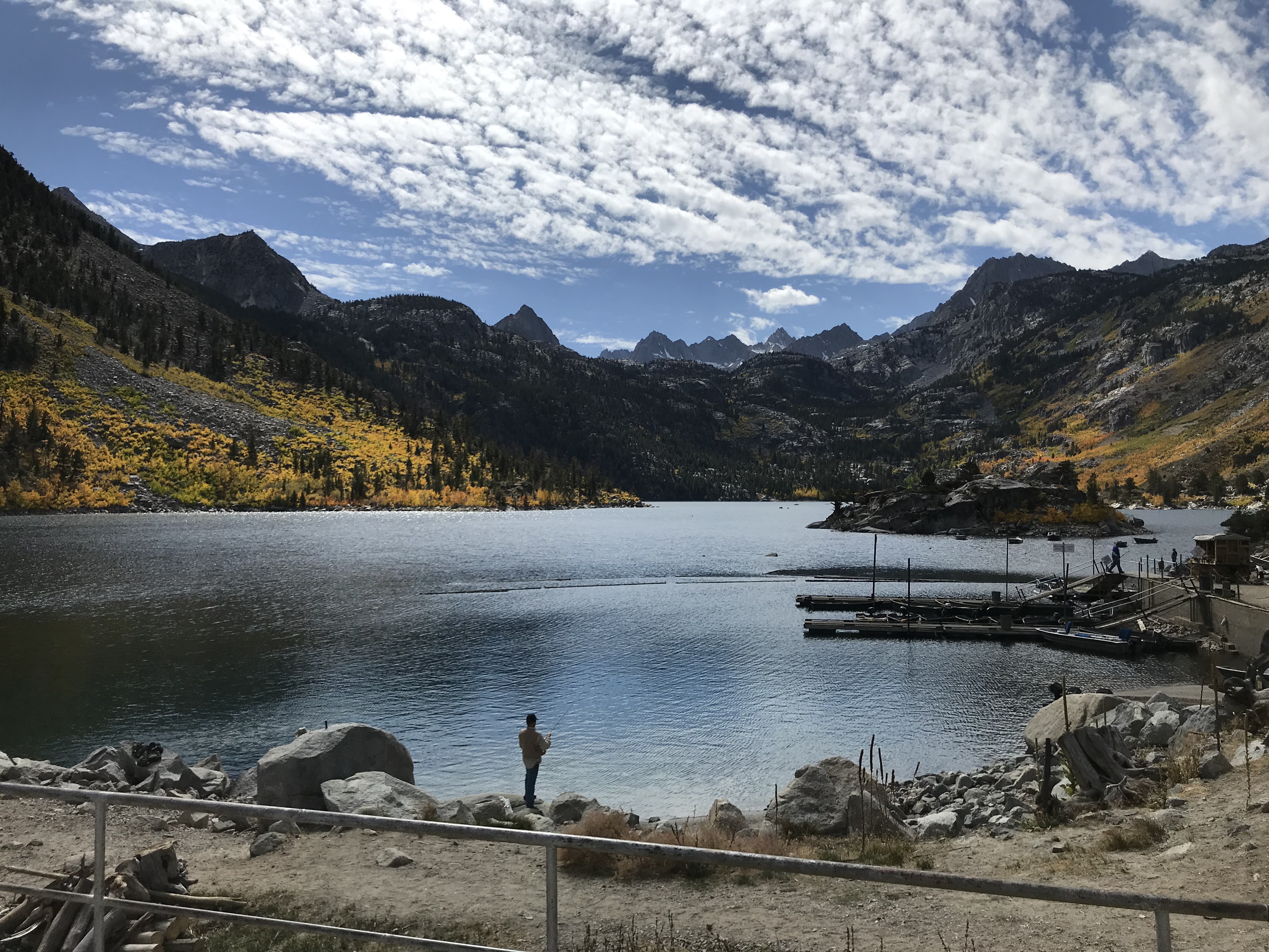
Lake Sabrina, Buttermilk county loop
To reach Lake Sabrina, you need to drive through buttermilk county loop (CA-168). The road was deserted as it was a monday morning (non-holiday). But surprisingly, when we reached the lake, we saw many people visiting that place and people were setting up their camps on the nearby camppsites. This road is closed in winters due to snow, but is a good place to visit in summers, and falls. On the way we saw a small village resort with beautiful fall colors. There is vista point where you can see the Cardinal Village resort on the foothills. If lucky, around 2 miles before lake sabrina, you can witness fall colors surrounding the bishop creek. The drive to the lake was mesmerizing and the fall colors made my day. I was waiting to see these colors throughout my trip.
This was our last stop in Mammoth basin, now we planned to drive back home. On the way we took a lunch stop at Mt. Whitney Fish Hatchery.
Mt. Whitney Fish Hatchery
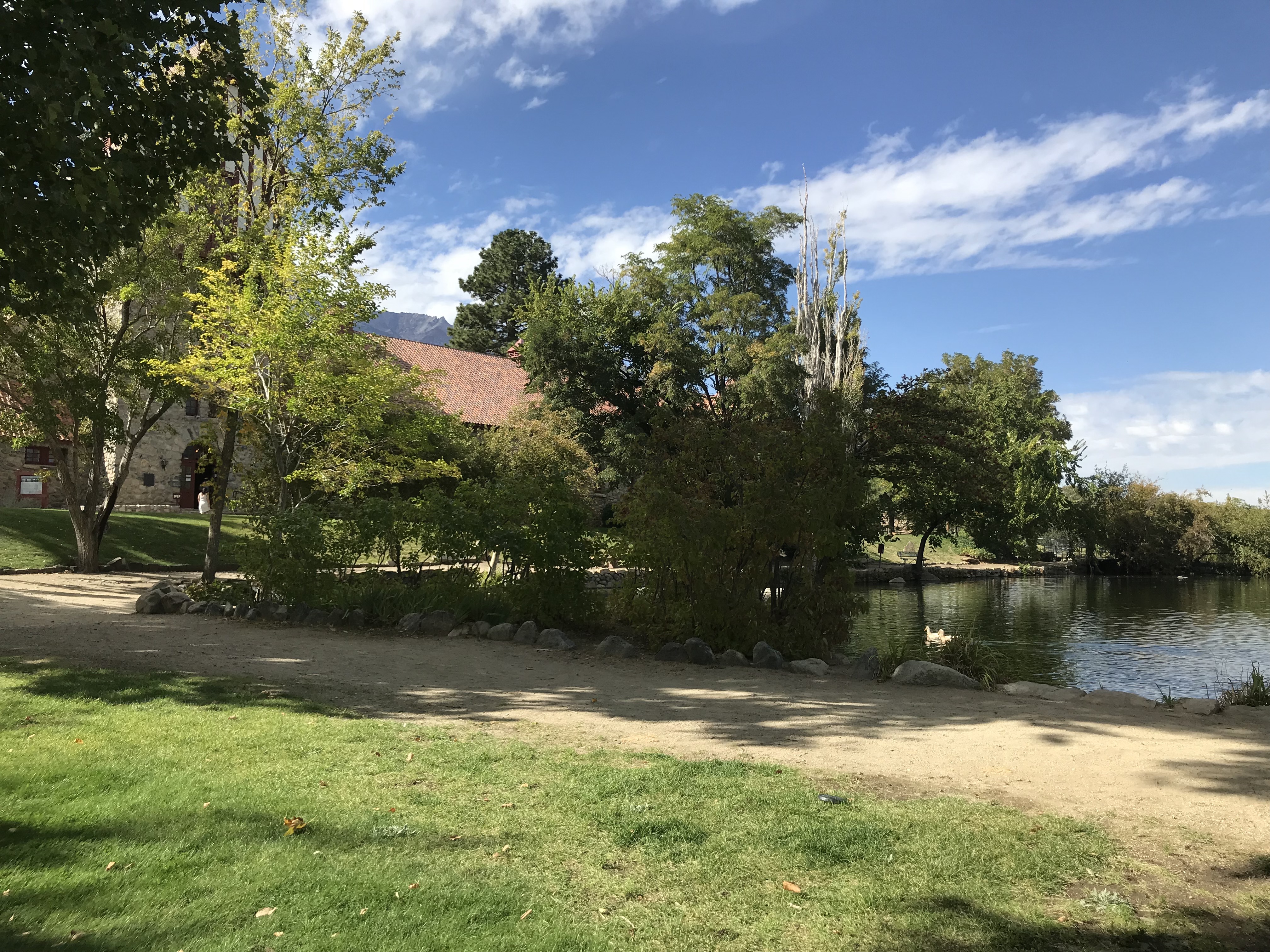
To reach this place take a right on to Fish Hatchery road from US-395 south. Drive down a mile from there to reach the enterace of the hatchery. This is a historic Fish Hatchery located in Independce, the county seat of Inyo county. There is a small pond and interpretive center which gives the visitors information about history of this place and its role in preservation of the golden trout, California's state fish. It has a beautiful park and lots of picnic table for family to enjoy.
We started from Mt. Whitney Fish Hatchery around 3 pm and drove back directly to woodland Hills. It took us 3.5 hours to reach back home.
(US-395S -> CA-14 -> I-5S -> I-405S -> US-101N)